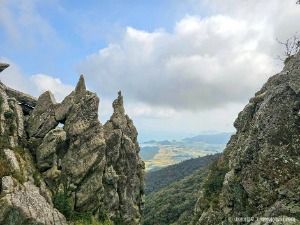
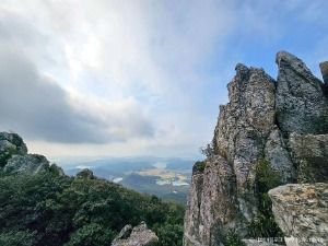
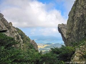
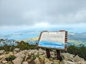
From its rocky ridge you can look down on the Haenam plains and the archipelago toward Wando and Jindo. There are 4 hiking routes. The round-trip route for beginners and Mihwangsa Temple visitors takes 3 hours. The traverse route from the entrance of Songchon Village to the Mibong-ri Spring parking lot takes 7 hours. Mihwangsa Temple stands halfway up the mountain, and parking is available.
Source: Korea Tourism Organization · KOGL Type 3 (no changes allowed) · 6 photos
6 photos ↓ · Source: Korea Tourism Organization · KOGL Type 3 (no changes allowed)
or Forest Protection Team, Forestry and Green Space Division: 061-530-5427 / Tourist information: 061-532-1330+82 61-530-5427, +82 61-532-1330 — source 2
Address
164 Mihwangsa-gil, Songji-myeon, Haenam-gun, Jeonnam-Gwangju Special Metropolitan City — source 3
How many km is Haenam's Dalmagodo Trail, and where else can I walk?
Dalmasan Mountain in detail
Dalmasan Mountain: a rocky ridge of about 8 km from Bulsseonbong Peak to Dosolbong Peak
Past Dakgoljae Pass, the gentle ridge suddenly turns into a rocky ridge. It runs about 8 km past Bulsseonbong Peak, the summit with a beacon platform, to Dosolbong Peak (421 m). The ridge ends only at Sajabong Peak (155 m) at Land's End, the southernmost point of the Korean Peninsula's mainland. The area designated Scenic Site No. 59 is Mihwangsa Temple on Dalmasan Mountain and its surroundings. source 1
Dalmasan Mountain: a loop of about 3 hours starting from Mihwangsa Temple
The loop course for beginners and Mihwangsa Temple visitors is about 5 km and takes 2 hours 30 minutes to 3 hours. Course 1 goes from Mihwangsa Temple past the camellia forest, Bulsseonbong Peak and Munbawi Rock, then back down to Mihwangsa Temple. Course 2 visits the East Stupa after Munbawi Rock and then returns. From Mihwangsa Temple via Dosoram Hermitage to the Mabong-ri Spring parking lot takes about 5 hours. From Songchon Village to Mihwangsa Temple takes about 4 hours. source 1
Dalmasan Mountain: the rocks and spring flowers of the Geumgangsan Mountain of Namdo
Its many strange rocks have earned it the name the Geumgangsan of the south. In spring, azaleas and royal azaleas bloom thickly in every gap of the rocky ridge. So in spring, hikers come from all over the country. source 2
How many hiking routes does Dalmasan Mountain have?
There are 4. They are the round-trip route for beginners and Mihwangsa Temple visitors (3 hours), the Mihwangsa Temple to Mibong-ri Spring route, the Songchon Village to Mihwangsa Temple route, and the traverse route (7 hours).
Where does the traverse route on Dalmasan Mountain start?
It starts at the entrance of Songchon Village and runs along a forest road and past Sujeong Cave and Seokmun Cave to the Mibong-ri Spring parking lot. It takes about 7 hours.
Can I park at the Dalmasan Mountain?
Yes, parking is available. For hiking inquiries, call 061-530-5229.




 Dalmagodo Trailsame coordinates
 Mihwangsa Templestraight-line 170 m

