Things to doNature and the seaHaenam, Munnae-myeon
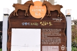
Imhado Island
In Korean: 임하도
Imhado Island has been connected to the mainland by a bridge since the Imha Bridge opened in 2010, and it is the only island in Haenam connected to the mainland.
It has an area of 0.55 km² and a coastline of 4.8 km, and finless porpoises, a native kind of Dolgorae, are often seen in the shallow sea around it. It is always open, there is no fee, and parking is available.
Source: Korea Tourism Organization · KOGL Type 3 (no changes allowed) · 6 photos
6 photos ↓ · Source: Korea Tourism Organization · KOGL Type 3 (no changes allowed)
Imhado Island Today
Worked out per date
Nov 4 (Wed)
Open at all times
Sources: Hours and closed days: Korea Tourism Organization
Touring Haenam without admission fees: which places are free?
Imhado Island in detail
Imhado Island: from an island shaped like two horses to an island of forests
Because the island looked like two horses, it was first called Imado. As the village's forest grew thick, the name was changed to Imhado Island. The village began around 1800, when members of the Hadong Jeong clan and the Gimhae Kim clan, caught in a storm at sea, stayed and settled on the island.
Imhado Island: black pine colonies and small islands linked by the tide
The island is made of low, gentle hills. Evergreen broadleaf trees such as camellia, coralberry, wax-leaf privet, eurya and spindle trees grow around colonies of black pine. The small islands beside it are linked to each other at low tide, when the water goes out. Mullet swimming up against the strong current of Uldolmok are also often seen.
Source: Korea Tourism Organization TourAPI
Imhado Island FAQ
Is Imhado Island connected to the mainland?
Yes. A land-link bridge (Imha Bridge) opened in 2010, so you can reach the island from the mainland by bridge.
Can I see finless porpoises at Imhado Island?
In the shallow sea around the island you can often see finless porpoises, a native kind of Dolgorae, and also many mullet cutting through the Uldolmok current.
Who do I contact about Imhado Island?
You can contact the Munnae-myeon Office (061-531-3562) or the Tourism Policy Team, Haenam-gun Office (061-530-5917).
Source: Korea Tourism Organization TourAPI
Imhado Island sources
Photos
Korea Tourism Organization · KOGL Type 3 (no changes allowed)